Hi, my name is Hans Hack
This is a selection of my work. I'm a data visualizer, map maker and artist working in Berlin. I work with Javascript (front end and back end), databases, open source GIS tools, image editing programs and whatever might come handy to realise a project. You need help to visualise, get or analyse data, find creative ways to get your message across or just want to have a chat? Feel free to contact me:

Selected clients: Asian Development Bank, Brand Eins, Monde diplomatique, taz, Tagesspiegel, VICE, WWF, Zeit Online
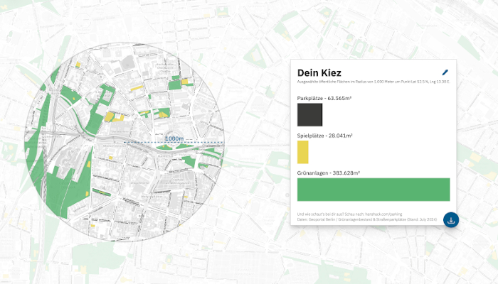
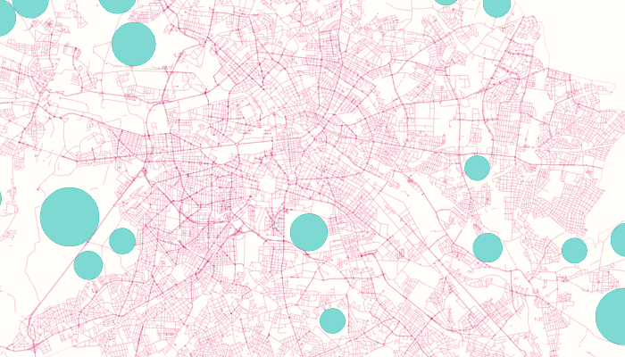
Parking or Playgroung
Compare the size of parking areas, playgrounds, and green spaces in your neighborhood, 2024
| ---> | hanshack.com/parking |

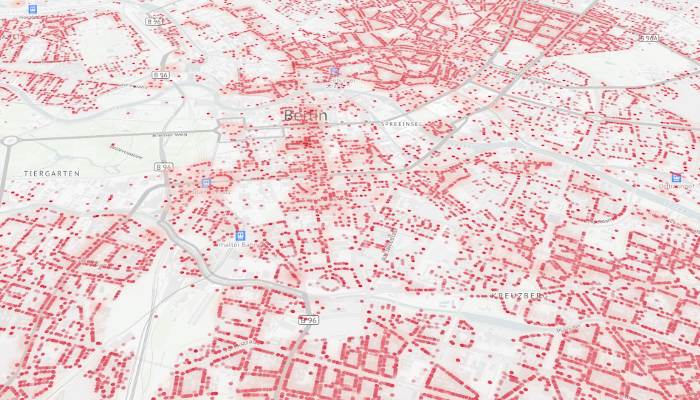
Street Canyons
A map experiment depicting Berlins streets as canyons, carving through the city's landscape, 2023
| ---> | hanshack.com/street-canyons |

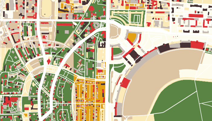
Kiez Colors
View the distribution of land use in your neighborhood, 2023
| ---> | kiezcolors.odis-berlin.de |
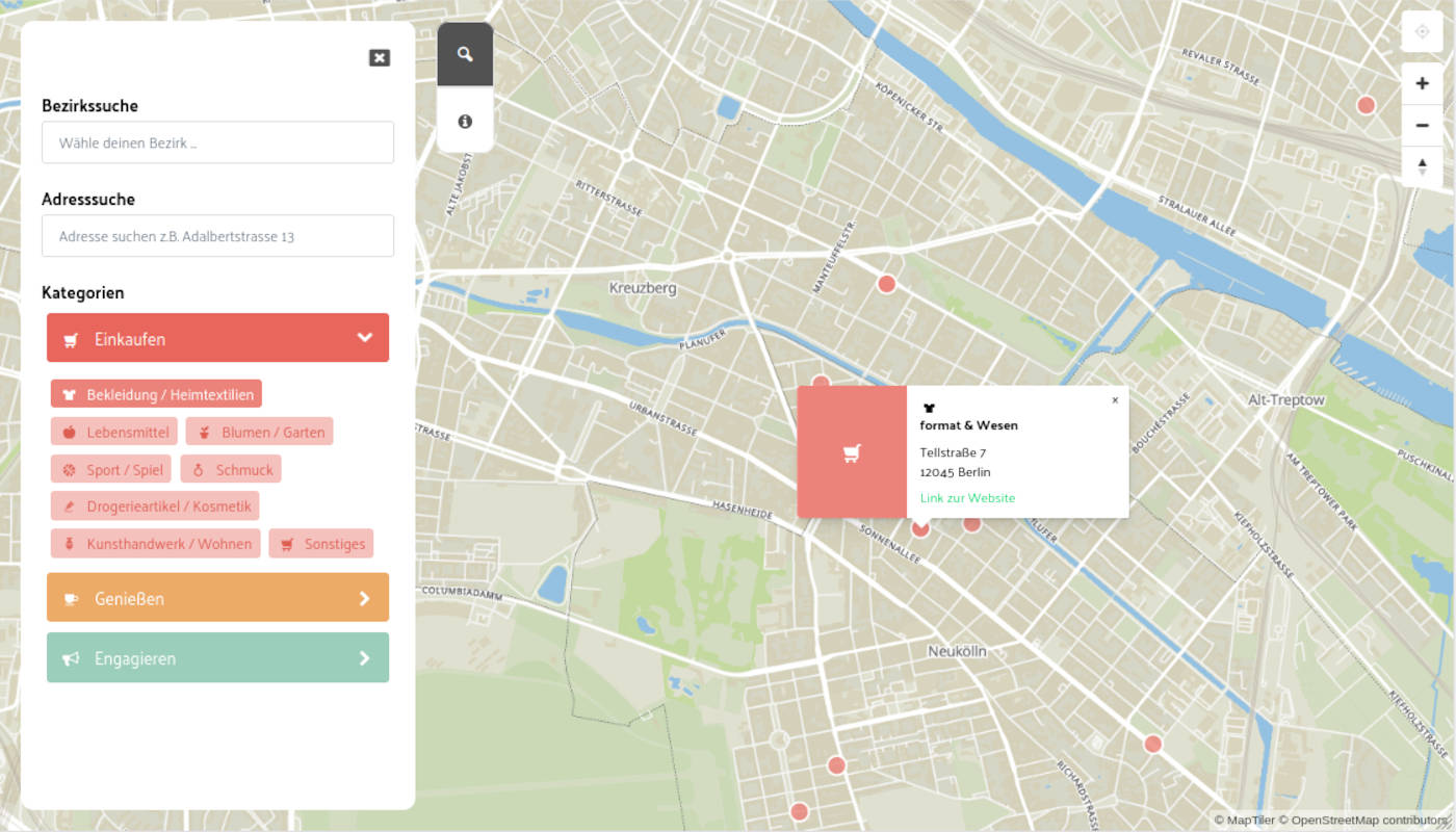
Branchenpuls
Explore Berlin's commercial landscape from the district to the neighborhood, 2023
| ---> | branchenpuls.berlin |
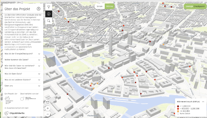
Energy Checkpoint
Explore energy consumption and renovation potential of public buildings, 2023
| ---> | energiecheckpoint.odis-berlin.de |

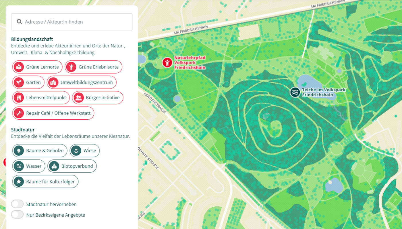
Kieznaturkarte (Nature map)
Explore Berlins nature, 2022
| ---> | naturerleben-xhain.berlin/kieznaturkarte/ |

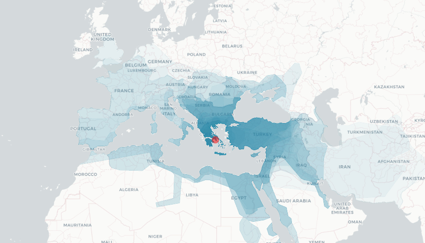
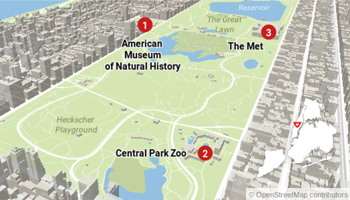
Point in History
Explore historical boundaries around a given point, 2022
| ---> | hanshack.com/point-in-history |

Magic Mapping Club
The Magic Mapping Club teaches you how to make interactive maps and show-off your spatial data, 2019
| ---> | magicmapping.club |


Bezirksregionenprofile
A tool to present reports from Berlins districts, 2019
| ---> | citylab-berlin.org/projects/districtprofiles/ |


Drowning Berlin in simulation
A experimental depiction of sea-level rise, 2018
| ---> | hanshack.com/berlin-drowned |
| ---> | about: medium |

Tutorial: OSM Filter
How to extract geodata from OpenStreetMap with Osmfilter, 2018
| ---> | journocode.com |

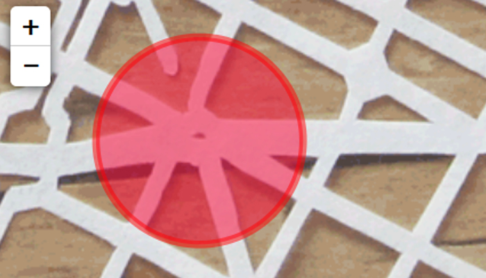
Places of inaccessibility
A journey of discovery to the points in Germany furthest away from streets, 2017
| ---> | hanshack.com/pointnemo |

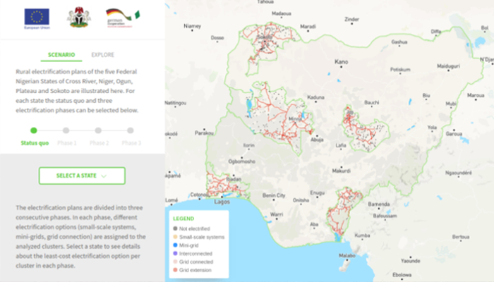
Nigerian rural electrification plans
A tool to explore the rural electrification plans for 5 Nigirian states, 2017
| ---> | rrep-nigeria.integration.org |
| client | GIZ, NESP, Integration, Reiner Lemoine Institut |


Myanmar off-grid analytics
A tool to explore the potential for off-grid electrification, 2017
| ---> | adb-myanmar.integration.org |
| client | Asian Development Bank, Integration, Reiner Lemoine Institut |

Calender Maker
A tool to generate multiple images on the basis of a editable spreadsheet, 2017
| ---> | brandeins.de |
| client | Brand Eins |

Reprojected Destruction
Aleppo's destruction reprojected onto London and Berlin, 2017
| ---> | hanshack.com/aleppo |
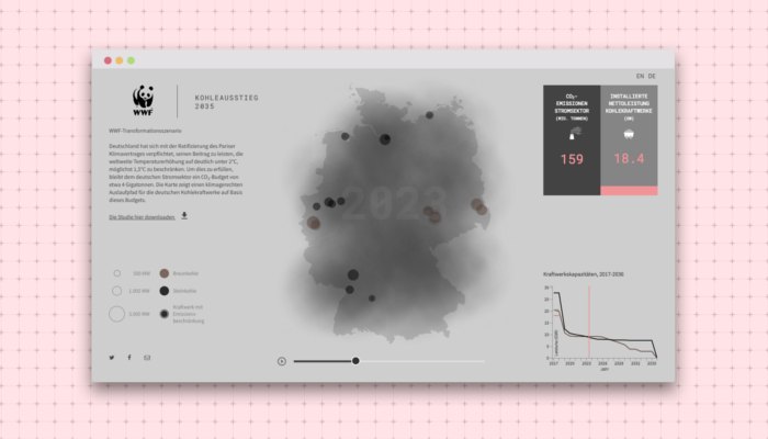
Coal phase-out
WWF transformation scenario for coal-fired power plants, 2017
| ---> | zukunft-stromsystem.de |
| client | WWF |

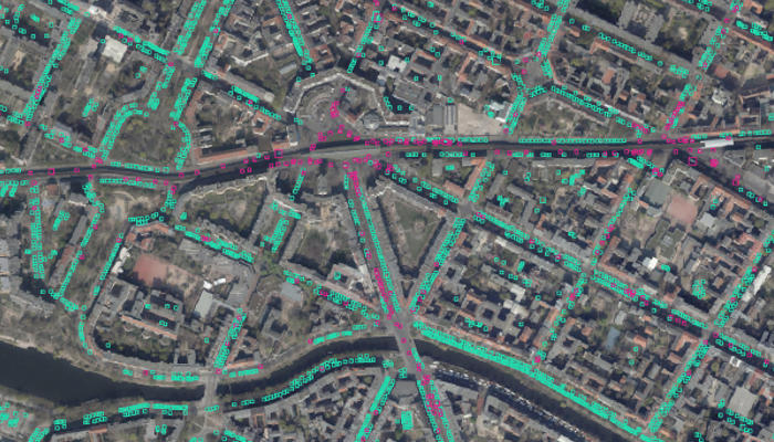
High resolution aerial images
1000x90cm high-res images for an exhibtion, based on multiple aerial images of Berlin, 2017
| client | Gedenkstätte Hohenschönhausen |

Analytics Tool
A tool for analysing data for an exhibition about Stasi Topography in Berlin, 2017
| client | Gedenkstätte Hohenschönhausen |

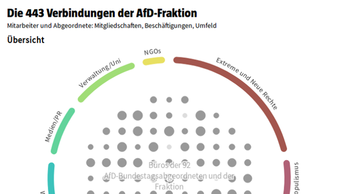
Wo Deutschland rechts wählt
Bundestag elections since 1990 - how support for far-right parties has shifted east, 2017
| ---> | website |
| with | Morgenpost interactive team |

Grenze zu Mexiko
Place Trump's planned Wall anywhere on a world map, 2016
| ---> | website |
| with | Morgenpost interactive team |
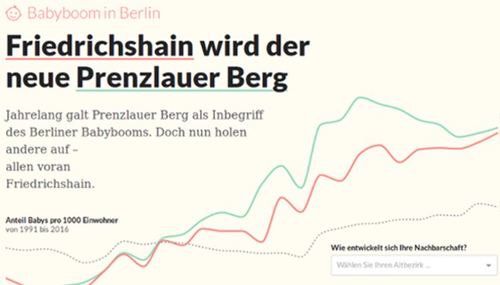
Babyboom in Berlin
Birth rate development in Berlin, 2016
| ---> | website |
| with | Morgenpost interactive team |
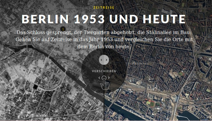
Time Travel
Compare aerial images of Berlin in 1953 and today, 2016
| ---> | website |
| with | Morgenpost interactive team |


Interactive electrification planning
A tool to explore electrification coverage in Nigeria, 2016
| client | GIZ, Integration, Reiner Lemoine Institut |
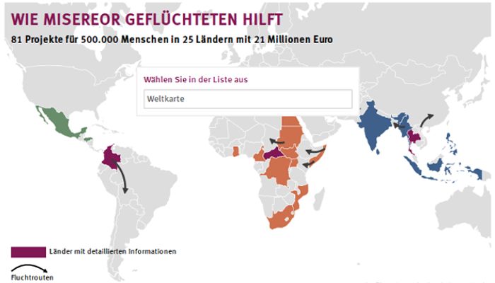
Wie Misereor Geflüchteten hilft
Interactive grafic about how Misereor is helping refugees, 2016
| ---> | website |
| client | Misereor |

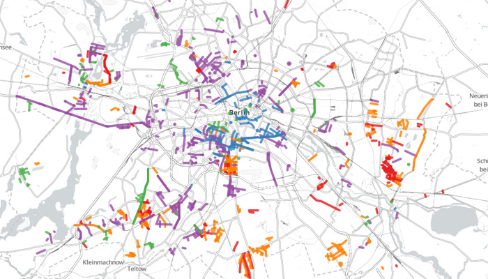
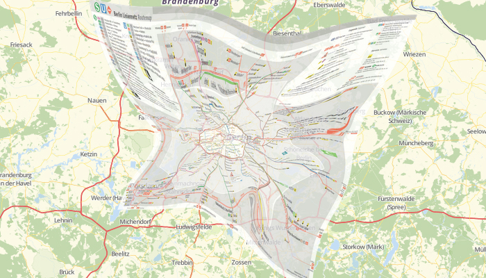
Verbindungslinien
Berlin's east- west division in today's public transport, 2016
| ---> | hanshack.com/verbindungslinien |

Flüchtlinge in Deutschland 2015
Refugee policies in Germany's federal states, 2016
| ---> | website |
| client | Boell Stiftung |

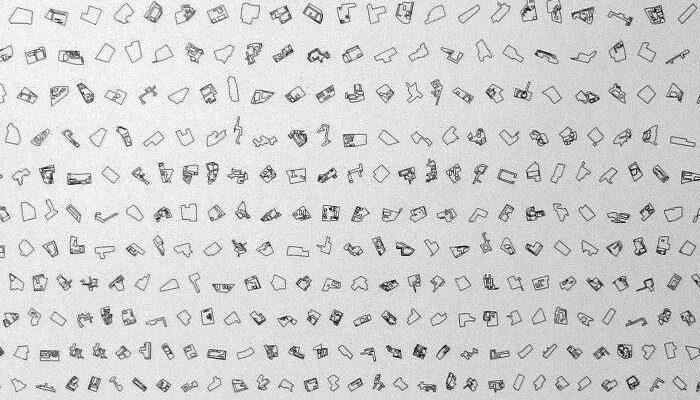
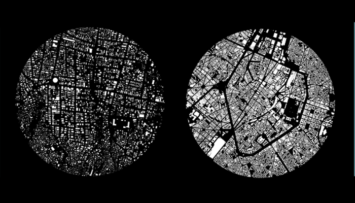
Reading Belgium
Footprints of various different building types in Belgium, 2015
| ---> | hanshack.com/belgium |


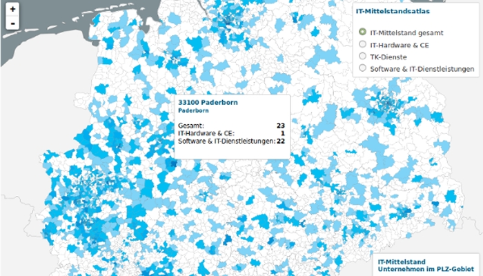
IT-Mittelstandsatlas
A map showing the distribution of medium-sized IT companies in Germany, 2015
| ---> | bitkom.org/mittelstandsatlas |
| for | lokaler |


Meinungsmaschine
Talkshow monitor of the four largest talkshows in Germany, 2015
| ---> | apps.lokaler.de/meinungsmaschine |
| for | lokaler |

If Gaza or Israel was in ...
What if Gaza or Israel was in your city ?, 2014
| ---> | apps.lokaler.de/israelgaza |
| for | lokaler |

Animated Map of Berlin
Animated map of Berlin, consisting of 3 layers, some fading and a map made with postgis, 2014
| ---> | hanshack.com/animatedmap.html |


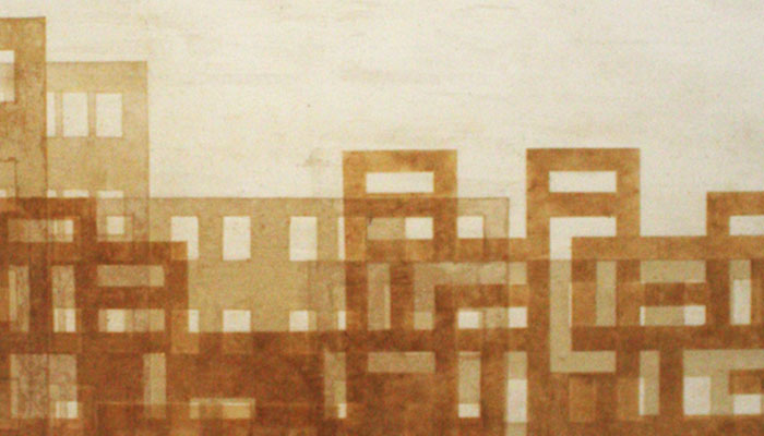
Cityscapes & Houses
A selection of paintings around the theme of cityscapes and houses, 2007-2014
| ---> | hanshack.com/cityscapes.html |